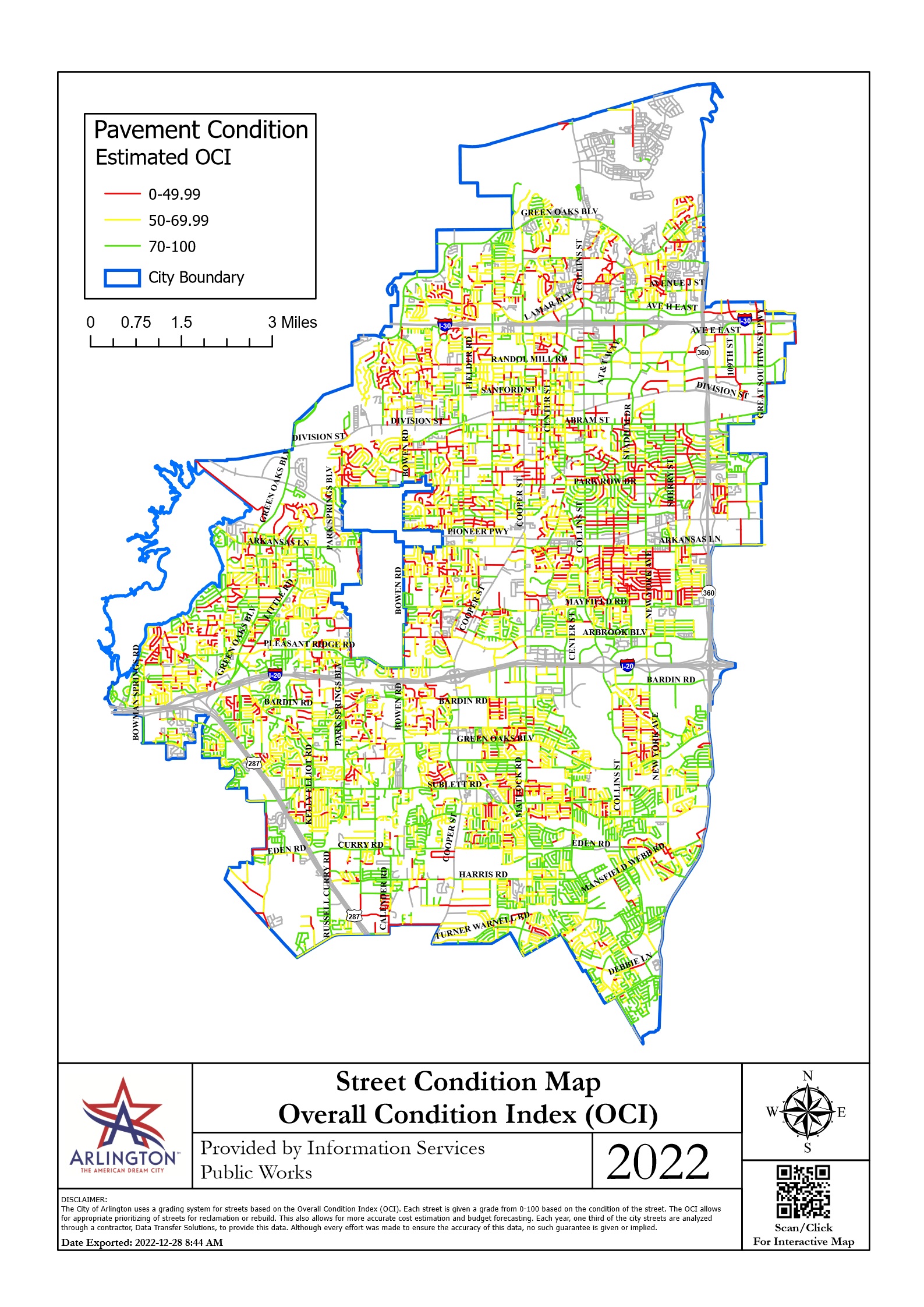
2022 Street Condition Map
This is a map showing the street conditions for all of Arlington as of 2022.
OCI (Overall Condition Index) is a measure of the quality of a road. 0 represents an impassable road while 100 is a road in excellent condition.
One thing you’ll notice while looking at the Arlington street condition map is the sheer volume of red roads, which are roads that are 0 to 50 on the OCI scale.
These are streets that need immediate repair, yet the vast majority are being ignored. You likely drive on many of these roads since the problem is so widespread.
Now that you’ve seen the scale of our infrastructure issues, compare it to the 2022-2023 Scheduled Street Repair map. Is 10.42 miles enough in a year?
Publicly-available map created and maintained by Arlington Public Works.
Current Public Works Projects
This map shows ongoing street maintenance in Arlington. You can use this to check whether scheduled street repairs are actually happening.
Publicly-available map created and maintained by Arlington Public Works.
2022-2023 Scheduled Street Repairs
This map was created by FixArlingtonStreets.com. It may be used and reproduced without permission and with credit
Sign up for The Free Monthly Road Report
Get the latest updates on Arlington road conditions, repairs, funding and more, so you can keep tabs on what is happening to the streets in your area!